

Heavy rainfall and historic flooding occurred across several parts of Missouri that were finding themselves needing the moisture, just not all at once.
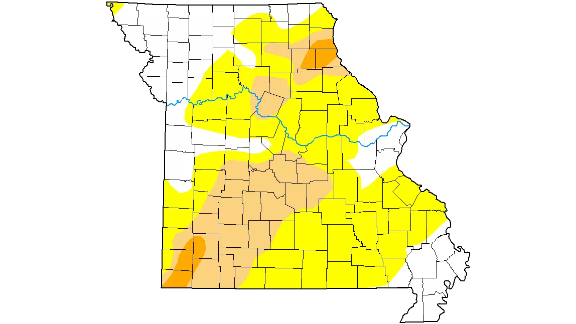
The weekly US Drought Monitor from the National Drought Mitigation Center found that conditions had actually worsened for Missouri as a whole in the week leading up to the heavy rains. Parts of 11 counties across South Central Missouri entered abnormal dryness, while moderate drought expanded into Phelps County, just weeks after a tornado had touched down in Rolla.
Locally, conditions improved as of last Tuesday, as a majority of Linn County exited abnormal dryness, and portions of Chariton, Macon and Randolph counties were upgraded from moderate drought to abnormal dryness. Northern Monroe County was upgraded from severe to moderate drought. Moderate drought was still present as of Thursday morning in Howard, most of Randolph, eastern Chariton, eastern Saline, and the northern edge of Cooper counties, along with southern Benton and Morgan counties.
23.44 percent of Missouri was in some stage of drought heading into the weekend, down four-tenths of one percentage point on the week. Another 48.48 percent is in abnormal dryness, leaving just 28.08 percent of Missouri in normal or excess moisture.
The U.S. Drought Monitor is jointly produced by the National Drought Mitigation Center at the University of Nebraska-Lincoln, the United States Department of Agriculture, and the National Oceanic and Atmospheric Administration. Map courtesy of NDMC.