

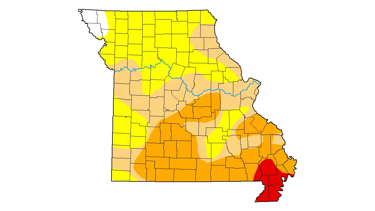

Drought map of Missouri as of Sep. 16, 2025 (The U.S. Drought Monitor is jointly produced by the National Drought Mitigation Center at the University of Nebraska-Lincoln, the United States Department of Agriculture, and the National Oceanic and Atmospheric Administration. Map courtesy of NDMC.)
Scattered showers early in the week allowed most of our area to show no change in this week’s USDA Drought Monitor, while other areas of Missouri fell into worse stages of drought.
The weekly monitor update released Thursday, Sept. 18, which shows conditions as of Tuesday morning, showed only downgrades for parts of four area counties. Northeastern Cooper and southern Ray counties, along with the western halves of Johnson and Lafayette counties, entered the first stage of drought condition, while the remainder of the area is unchanged in either abnormal dryness or moderate drought. Elsewhere in Missouri, moderate drought spread along the Mississippi River into part of Northeast Missouri, while the Bootheel entered extreme drought.
3.56 percent of Missouri is now in extreme drought, which is one step below the worst level of drought conditions. Another 27.90 percent is in severe drought, while 30.42 percent of the state is in moderate drought. Just 2.22 percent of the state continues to experience normal or excess moisture.
Thursday’s rainfall through our area, including 0.31″ in Marshall, will factor into next week’s drought monitor update.