

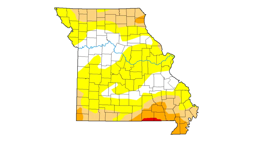
Drought map of Missouri as of Mar. 17, 2026 (The U.S. Drought Monitor is jointly produced by the National Drought Mitigation Center at the University of Nebraska-Lincoln, the United States Department of Agriculture, and the National Oceanic and Atmospheric Administration. Map courtesy of NDMC.)
This week’s US Drought Monitor for Missouri indicates that more of the state, especially our area, should have had more green on St Patrick’s Day as abnormally dry conditions decreased.
The weekly update, based on conditions as of Tuesday, Mar. 17, shows an end to abnormally dry conditions for Chariton, Howard, Lafayette, Pettis, Ray and Saline counties, along with most of Cooper and southern Randolph counties. Moderate drought retreated from Randolph and most of Macon counties in the past week, as prolonged showers and even snowfall provided needed moisture to the area.
Still, 26.74% of Missouri is in moderate or worse stages of drought, with extreme drought present in two counties along the Arkansas border, and severe drought lingering in the northern half of Northeast Missouri’s Lewis County. Another 50.57% of the state remains in abnormal dryness. That results in 22.69% of Missouri having normal or excess moisture, a 17-point increase from last week.