

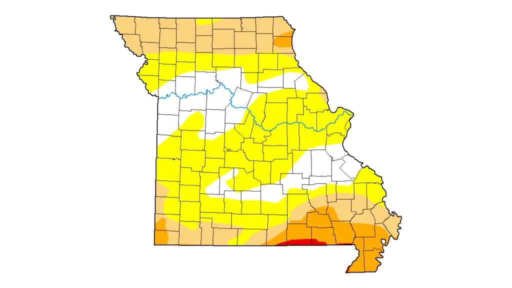
Drought map of Missouri as of Mar. 31, 2026 (The U.S. Drought Monitor is jointly produced by the National Drought Mitigation Center at the University of Nebraska-Lincoln, the United States Department of Agriculture, and the National Oceanic and Atmospheric Administration. Map courtesy of NDMC.)
Even before this week’s heavy rainfall, most of Missouri’s midsection was finding itself exiting drought or abnormally dry conditions.
The weekly U.S. Drought Monitor update, based on conditions as of Tuesday, Mar. 31, 2026, showed abnormally dry conditions remaining present in most of Benton, Boone, Johnson, Moniteau and Morgan counties, along with northern Randolph County. Moderate drought persists north of U.S. Route 36, including the northern quarter of Linn and Macon counties, while the rest of those two counties join Livingston and Caldwell counties in abnormal dryness.
Statewide, the monitor showed little change from last week, with the only notable change being the return of moderate drought to portions of three Southeast Missouri counties. In total, 32.09% of Missouri is in some stage of drought, up 1.16 percentage points from the previous week. 21.49% of Missouri, including all of Carroll, Howard, Lafayette, Pettis and Saline counties, reported normal or excess moisture ahead of this week’s arrival of rainy weather.