

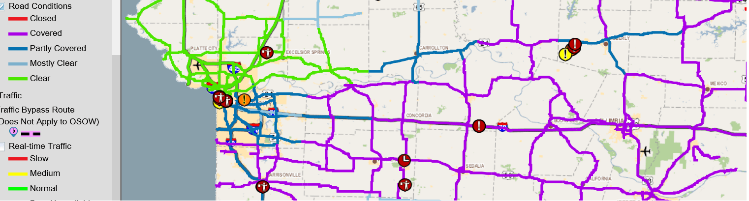
The map picture above illustrates the current road conditions within Cooper, Chariton, Carroll, Lafayette, Pettis, Johnson, Howard, and Saline counties. In the map, the purple highlighted area indicates covered roads, light blue signifies mostly clear roads, and dark blue indicates partly covered roads.
For a more in-depth look at the map and detailed information on road conditions, please visit the link provided below.
Stay informed and make safe travel decisions based on the latest updates.